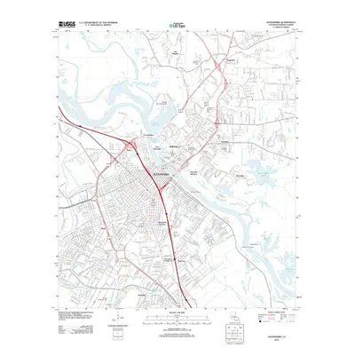
2012 Map of Alexandria
USGS Topo · Published 2012About this map
Alexandria and Pineville sit at the center of this 2012 survey, linked by crossings of the Red River. The landscape is a mix of urban density and historical preservation, notably flanking the river with Fort Randolph and Fort Buhlow. The region's diverse heritage is evident in its numerous burial grounds, ranging from the Alexandria National Cem to the Bnai Israel Cem and Lincoln Memorial Cem.
Find a feature on this map
396 named features on this map. Tap any name to fly to it.
Don’t see what you’re looking for? This feature index may not catch every label — zoom into the map to look around manually.
Map Details
Editions of this 2012 Alexandria Map
This is the sole edition of this map. No revisions or reprints were ever made.
Other maps of this area

1932 · Boyce NE
USGS Topo · 1:31,680

1935 · Lecompte
USGS Topo · 1:62,500

1941 · Alexandria
USGS Topo · 1:62,500

1941 · Boyce
USGS Topo · 1:62,500

1945 · Boyce SE
USGS Topo · 1:31,680

1949 · Boyce SE
USGS Topo · 1:31,680

1953 · Alexandria
USGS Topo · 1:250,000

1955 · Alexandria
USGS Topo · 1:250,000

1956 · Forest Hill
USGS Topo · 1:62,500

1956 · Boyce
USGS Topo · 1:62,500