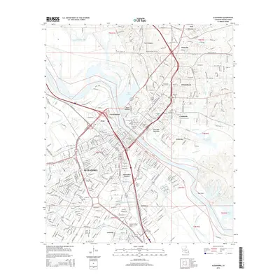
2015 Map of Alexandria
USGS Topo · Published 2015About this map
The Red River carves a dividing line through this urbanized corridor, separating the city of Alexandria from Pineville. This 2015 layout details a landscape deeply connected to its riverine history, where defensive positions like Fort Randolph and Fort Buhlow once guarded the bends of the river. The area is dense with community heritage markers, including the Anandale Cem and Maryhill Seminary Cem to the north.
Find a feature on this map
61 named features on this map. Tap any name to fly to it.
Don’t see what you’re looking for? This feature index may not catch every label — zoom into the map to look around manually.
Map Details
Editions of this 2015 Alexandria Map
This is the sole edition of this map. No revisions or reprints were ever made.
Other maps of this area

1932 · Boyce NE
USGS Topo · 1:31,680

1935 · Lecompte
USGS Topo · 1:62,500

1941 · Alexandria
USGS Topo · 1:62,500

1941 · Boyce
USGS Topo · 1:62,500

1945 · Boyce SE
USGS Topo · 1:31,680

1949 · Boyce SE
USGS Topo · 1:31,680

1953 · Alexandria
USGS Topo · 1:250,000

1955 · Alexandria
USGS Topo · 1:250,000

1956 · Forest Hill
USGS Topo · 1:62,500

1956 · Boyce
USGS Topo · 1:62,500