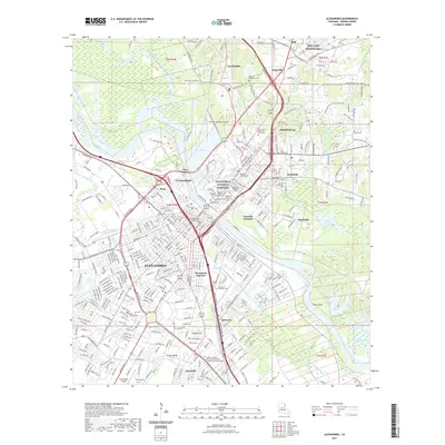
2021 Map of Alexandria
USGS Topo · Published 2021About this map
The Red River divides the urban centers of Alexandria and Pineville in this detailed 2021 survey of Central Louisiana. This river corridor has long served as a strategic hub, evidenced by the historical grounds of Fort Randolph and Fort Buhlow situated overlooking the banks. The map documents a dense concentration of civic and spiritual history, from the Alexandria National Cemetery to the campus of Louisiana College. Settlement patterns expand outward into established neighborhoods like Lee Heights and Anandale, while the northeast corner is dominated by the military presence of SMR Camp Beauregard. This modern record effectively traces the evolution of the region's transport network, showing how the historic Alexandria Junction and Pineville Junction remain central to the local infrastructure alongside industrial zones near Samtown.
Find a feature on this map
100 named features on this map. Tap any name to fly to it.
Don’t see what you’re looking for? This feature index may not catch every label — zoom into the map to look around manually.
Map Details
Editions of this 2021 Alexandria Map
This is the sole edition of this map. No revisions or reprints were ever made.
Other maps of this area

1932 · Boyce NE
USGS Topo · 1:31,680

1935 · Lecompte
USGS Topo · 1:62,500

1941 · Alexandria
USGS Topo · 1:62,500

1941 · Boyce
USGS Topo · 1:62,500

1945 · Boyce SE
USGS Topo · 1:31,680

1949 · Boyce SE
USGS Topo · 1:31,680

1953 · Alexandria
USGS Topo · 1:250,000

1955 · Alexandria
USGS Topo · 1:250,000

1956 · Forest Hill
USGS Topo · 1:62,500

1956 · Boyce
USGS Topo · 1:62,500