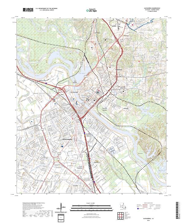
2024 Map of Alexandria
USGS Topo · Published 2024About this map
Alexandria and Pineville dominate the landscape on either side of the Red River, a regional hub defined by military history and institutional presence. The map displays a dense network of civic and memorial sites, including the Alexandria National Cem and the sprawling grounds of Camp Beauregard to the northeast. Civil War-era heritage is anchored by Fort Buhlow and Fort Randolph, which overlook the river bend near Lake Buhlow.
Find a feature on this map
395 named features on this map. Tap any name to fly to it.
Don’t see what you’re looking for? This feature index may not catch every label — zoom into the map to look around manually.
Map Details
Editions of this 2024 Alexandria Map
This is the sole edition of this map. No revisions or reprints were ever made.
Other maps of this area

1932 · Boyce NE
USGS Topo · 1:31,680

1935 · Lecompte
USGS Topo · 1:62,500

1941 · Alexandria
USGS Topo · 1:62,500

1941 · Boyce
USGS Topo · 1:62,500

1945 · Boyce SE
USGS Topo · 1:31,680

1949 · Boyce SE
USGS Topo · 1:31,680

1953 · Alexandria
USGS Topo · 1:250,000

1955 · Alexandria
USGS Topo · 1:250,000

1956 · Forest Hill
USGS Topo · 1:62,500

1956 · Boyce
USGS Topo · 1:62,500