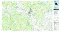
1986 Map of Alexandria
USGS Topo · Published 1986About this map
The Red River corridor defines the heart of Central Louisiana in the mid-1980s, where the twin cities of Alexandria and Pineville anchor a landscape of mixed river bottomlands and dense pine forests. Military footprints are prominent, with England Air Force Base situated west of the river and the Camp Beauregard National Guard installation to the northeast. To the southwest, the expansive Fort Polk Military Reservation transitions into the Kisatchie National Forest, marking the region's long-standing connection to timber and defense.
Find a feature on this map
174 named features on this map. Tap any name to fly to it.
Don’t see what you’re looking for? This feature index may not catch every label — zoom into the map to look around manually.
Map Details
Editions of this 1986 Alexandria Map
2 editions found
Other maps of this area

1932 · Boyce NE
USGS Topo · 1:31,680

1932 · Boyce SW
USGS Topo · 1:31,680

1932 · Colfax SW
USGS Topo · 1:31,680

1932 · Colfax SE
USGS Topo · 1:31,680

1935 · Pawnee
USGS Topo · 1:31,680

1935 · Turkey Creek
USGS Topo · 1:62,500

1935 · Tooleys
USGS Topo · 1:62,500

1935 · Lecompte
USGS Topo · 1:62,500

1936 · Colfax
USGS Topo · 1:62,500

1936 · Pollock
USGS Topo · 1:62,500