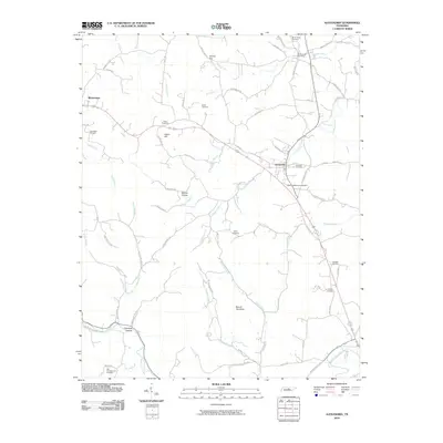
2010 Map of Alexandria
USGS Topo · Published 2010About this map
Watertown and Alexandria serve as the primary hubs in this central Tennessee landscape, connected by a network of rural roads that navigate a series of significant hollows and ridges. The terrain is defined by prominent elevations such as Round Top Knob and Hearn Hill, while the drainage pattern of Smith Fork Creek, Brush Creek, and Helton Creek dictates the placement of early homesteads and transport corridors. The map reveals a high density of family and community burial grounds, including the Grandstaff Cemetery, Smith Cemetery, and Talley Cemetery, which are scattered along the creek valleys. A distinct historical marker is the Brush Creek Post Office near the northern boundary, while geographic features like Holmes Gap and Chumley Hollow illustrate the localized nomenclature of the region's topography.
Find a feature on this map
70 named features on this map. Tap any name to fly to it.
Don’t see what you’re looking for? This feature index may not catch every label — zoom into the map to look around manually.
Map Details
Editions of this 2010 Alexandria Map
This is the sole edition of this map. No revisions or reprints were ever made.
Other maps of this area

1893 · Mc Minnville
USGS Topo · 1:125,000

1895 · Mc Minnville
USGS Topo · 1:125,000

1908 · Woodbury
USGS Topo · 1:62,500

1928 · Gordonsville
USGS Topo · 1:62,500

1942 · Statesville
USGS Topo · 1:100,000

1953 · Chattanooga
USGS Topo · 1:250,000

1956 · Columbia
USGS Topo · 1:250,000

1956 · Corbin
USGS Topo · 1:250,000

1956 · Nashville
USGS Topo · 1:250,000

1957 · Chattanooga
USGS Topo · 1:250,000