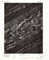
1977 Map of Alfarata
USGS Topo · Published 1979About this map
Alfarata is positioned within a narrow, cultivated valley defined by the linear ridges of central Pennsylvania. This orthophotoquad, derived from aerial photography taken in the spring of 1977, reveals a landscape dominated by long, thin agricultural strips that follow the base of Jacks Mountain. The tight spatial relationship between the highland forests and the lowland farm plots is a defining characteristic of this region. The drainage of Jacks Creek winds through the valley floor, providing a natural corridor alongside the settled areas. To the southeast, the slopes of Shade Mountain rise abruptly, forming a natural boundary for the valley's development. This 1970s view provides clear evidence of the land-use patterns and rural settlement density during a period of established agricultural stability in Mifflin County.
Find a feature on this map
5 named features on this map. Tap any name to fly to it.
Don’t see what you’re looking for? This feature index may not catch every label — zoom into the map to look around manually.
Map Details
Editions of this 1977 Alfarata Map
This is the sole edition of this map. No revisions or reprints were ever made.
Other maps of this area

1924 · Centre Hall
USGS Topo · 1:62,500

1924 · Lewistown
USGS Topo · 1:62,500

1925 · Mifflintown
USGS Topo · 1:48,000

1927 · Lewisburg
USGS Topo · 1:62,500

1929 · Centre Hall
USGS Topo · 1:62,500

1934 · Mifflintown
USGS Topo · 1:62,500

1937 · Mifflintown
USGS Topo · 1:62,500

1937 · Millheim
USGS Topo · 1:48,000

1941 · Millheim
USGS Topo · 1:62,500

1943 · Lewistown
USGS Topo · 1:125,000
Featured Places
- Decatur Township, PA
- Derry Township, PA
- Armagh Township, PA
- Snook, Decatur Township
- Shindle, Decatur Township