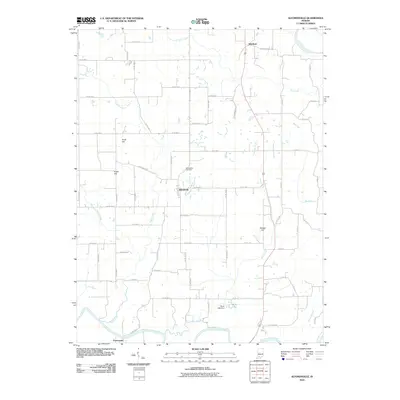
2010 Map of Alfordsville
USGS Topo · Published 2010About this map
Alfordsville sits at the center of this rural Indiana landscape, where the agricultural grid meets the meandering path of Sugar Creek. The village is anchored by the Alfordsville Cemetery, serving as a central point for local genealogy. To the north, the small settlement of Whitfield lies near Haw Creek, while the southern border is defined by the East Fork White River and the community of Portersville.
Find a feature on this map
64 named features on this map. Tap any name to fly to it.
Don’t see what you’re looking for? This feature index may not catch every label — zoom into the map to look around manually.
Map Details
Editions of this 2010 Alfordsville Map
This is the sole edition of this map. No revisions or reprints were ever made.
Other maps of this area

1902 · Ditney
USGS Topo · 1:125,000

1903 · Velpen
USGS Topo · 1:62,500

1944 · Montgomery
USGS Topo · 1:24,000

1944 · Glendale
USGS Topo · 1:24,000

1946 · Jasper
USGS Topo · 1:24,000

1950 · Shoals
USGS Topo · 1:24,000

1954 · Dubois
USGS Topo · 1:24,000

1956 · Alfordsville
USGS Topo · 1:24,000

1956 · Loogootee
USGS Topo · 1:24,000

1956 · Rusk
USGS Topo · 1:24,000