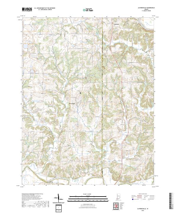
2022 Map of Alfordsville
USGS Topo · Published 2022About this map
Alfordsville sits at the center of this rural landscape, positioned within a network of county roads that link the small settlements of Whitfield to the north and Portersville along the southern border. The terrain is defined by the winding course of the East Fork White River and its numerous tributaries, including Sugar Creek, Slate Creek, and Haw Cr. This drainage system has carved a series of prominent elevations into the countryside, such as Knob Hill, Knott Hill, and Hopper Hill. Local history is anchored by sites like the Alfordsville Cem and thoroughfares such as Truelove Church Rd. The map also details smaller water features like Baver Lake and Barn Run, showing a topography where agricultural land and wooded creek bottoms follow the natural contours of the river valley.
Find a feature on this map
85 named features on this map. Tap any name to fly to it.
Don’t see what you’re looking for? This feature index may not catch every label — zoom into the map to look around manually.
Map Details
Editions of this 2022 Alfordsville Map
This is the sole edition of this map. No revisions or reprints were ever made.
Other maps of this area

1902 · Ditney
USGS Topo · 1:125,000

1903 · Velpen
USGS Topo · 1:62,500

1944 · Montgomery
USGS Topo · 1:24,000

1944 · Glendale
USGS Topo · 1:24,000

1946 · Jasper
USGS Topo · 1:24,000

1950 · Shoals
USGS Topo · 1:24,000

1954 · Dubois
USGS Topo · 1:24,000

1956 · Alfordsville
USGS Topo · 1:24,000

1956 · Loogootee
USGS Topo · 1:24,000

1956 · Rusk
USGS Topo · 1:24,000