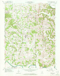
1956 Map of Alfordsville
USGS Topo · Published 1972About this map
Alfordsville serves as the central hub of this mid-1950s survey of the tri-county borderlands where Daviess, Martin, and Dubois counties meet. The landscape is defined by the winding course of the East Fork White River in the north and south, while the interior is a network of small creeks like East Fork Sugar Creek and Slate Creek. The map records a rural society anchored by several small country congregations, including Truelove Ch and Old Union Ch. A notable industrial presence is seen in the clusters of Strip Mine operations scattered between Whitfield and Alfordsville, illustrating the extraction economy that existed alongside traditional farming. High points like Knob Hill and Knott Hill rise above the drainage basins, providing a clear picture of the local topography before modern development altered the footprint of these small farming communities.
Find a feature on this map
33 named features on this map. Tap any name to fly to it.
Don’t see what you’re looking for? This feature index may not catch every label — zoom into the map to look around manually.
Map Details
Editions of this 1956 Alfordsville Map
2 editions found
Other maps of this area

1902 · Ditney
USGS Topo · 1:125,000

1903 · Velpen
USGS Topo · 1:62,500

1944 · Montgomery
USGS Topo · 1:24,000

1944 · Glendale
USGS Topo · 1:24,000

1946 · Jasper
USGS Topo · 1:24,000

1950 · Shoals
USGS Topo · 1:24,000

1954 · Dubois
USGS Topo · 1:24,000

1956 · Alfordsville
USGS Topo · 1:24,000

1956 · Loogootee
USGS Topo · 1:24,000

1956 · Rusk
USGS Topo · 1:24,000