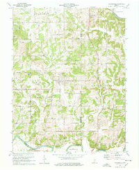
1978 Map of Alfordsville
USGS Topo · Published 1978About this map
Alfordsville serves as the central hub of this Southern Indiana landscape, situated where several branches of the local road network converge. The terrain is defined by the winding course of the East Fork White River, which forms a significant natural boundary to the south and northeast, complemented by tributaries like Haw Creek and Slate Creek. The 1970s land use reflects a mix of traditional rural life and industrial extraction, evidenced by the numerous Strip Mines and clusters of Oil Wells scattered across the northern sections.
Find a feature on this map
40 named features on this map. Tap any name to fly to it.
Don’t see what you’re looking for? This feature index may not catch every label — zoom into the map to look around manually.
Map Details
Editions of this 1978 Alfordsville Map
This is the sole edition of this map. No revisions or reprints were ever made.
Other maps of this area

1902 · Ditney
USGS Topo · 1:125,000

1903 · Velpen
USGS Topo · 1:62,500

1944 · Montgomery
USGS Topo · 1:24,000

1944 · Glendale
USGS Topo · 1:24,000

1946 · Jasper
USGS Topo · 1:24,000

1950 · Shoals
USGS Topo · 1:24,000

1954 · Dubois
USGS Topo · 1:24,000

1956 · Alfordsville
USGS Topo · 1:24,000

1956 · Loogootee
USGS Topo · 1:24,000

1956 · Rusk
USGS Topo · 1:24,000