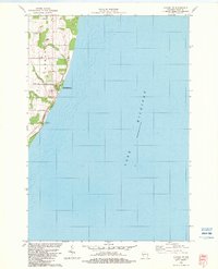
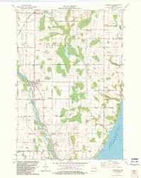
1982 Map of Algoma NE
USGS Topo · Published 1983About this map
The dramatic shoreline of Lake Michigan in Door County is defined here by the prominent bluffs of Clay Banks, where the land drops sharply toward the water. This early 1980s landscape reveals a rural coastal economy transitioning between agriculture and conservation, centered around the small settlement of Salona. The presence of the Schuyler Creek State Fishery Area and LaSalle County Park highlights the importance of the lakefront for both environmental management and public recreation during this era.
Find a feature on this map
18 named features on this map. Tap any name to fly to it.
Don’t see what you’re looking for? This feature index may not catch every label — zoom into the map to look around manually.
Map Details
Editions of this 1982 Algoma NE Map
This is the sole edition of this map. No revisions or reprints were ever made.
Other maps of this area

1954 · Manitowoc
USGS Topo · 1:250,000

1958 · Manitowoc
USGS Topo · 1:250,000

1960 · Sturgeon Bay
USGS Topo · 1:62,500

1960 · Jacksonport
USGS Topo · 1:62,500

1960 · Algoma
USGS Topo · 1:62,500

1981 · Sturgeon Bay West
USGS Topo · 1:24,000
1981 · Sturgeon Bay East
USGS Topo · 1:24,000
1982 · Algoma
USGS Topo · 1:24,000
1982 · Jacksonport SW
USGS Topo · 1:24,000
1982 · Forestville
USGS Topo · 1:24,000