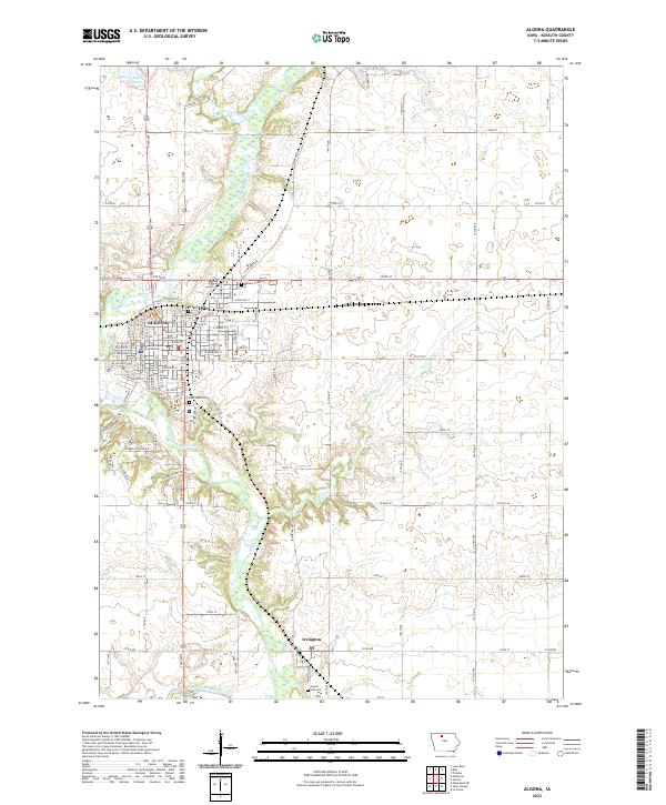
2022 Map of Algona
USGS Topo · Published 2022About this map
The East Fork Des Moines River defines the central axis of this modern Iowa survey, winding southward past the regional hub of Algona and the smaller community of Irvington. The urban center of Algona shows a dense street grid anchored by the Kossuth County Courthouse, while its edges are marked by several local burial grounds including Riverview Cem and East Lawn Cem. The surrounding township lands are meticulously divided by a geometric network of county roads like 140th Ave and 220th St. To the north, the convergence of Black Cat Creek and the main river channel creates a series of wetlands and lakes, most notably Lake Smith. This map provides a detailed view of the rural-to-urban transition in North Central Iowa, illustrating how waterways like Purcell Cr continue to influence the layout of agricultural holdings and the expansion of the county seat.
Find a feature on this map
82 named features on this map. Tap any name to fly to it.
Don’t see what you’re looking for? This feature index may not catch every label — zoom into the map to look around manually.
Map Details
Editions of this 2022 Algona Map
This is the sole edition of this map. No revisions or reprints were ever made.
Other maps of this area

1954 · Fairmont
USGS Topo · 1:250,000

1954 · Fort Dodge
USGS Topo · 1:250,000

1957 · Fort Dodge
USGS Topo · 1:250,000

1958 · Fort Dodge
USGS Topo · 1:250,000

1958 · Fairmont
USGS Topo · 1:250,000

1972 · Algona
USGS Topo · 1:24,000

1972 · St. Joseph
USGS Topo · 1:24,000

1972 · Titonka
USGS Topo · 1:24,000

1972 · Burt
USGS Topo · 1:24,000
1972 · Sexton
USGS Topo · 1:24,000