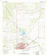
1963 Map of Alice North
USGS Topo · Published 1964About this map
The city of Alice serves as a concentrated hub of industry and education in the early 1960s, defined by its position at the junction of the Southern Pacific railroad lines. The landscape surrounding the town is heavily marked by the energy sector, featuring the Alice North Oil Field, Embleton Oil Field, and Bentonville Oil Field. These fields, dotted with oil wells and drilling holes, indicate the mid-century petroleum boom that shaped Jim Wells County.
Find a feature on this map
42 named features on this map. Tap any name to fly to it.
Don’t see what you’re looking for? This feature index may not catch every label — zoom into the map to look around manually.
Map Details
Editions of this 1963 Alice North Map
2 editions found
Other maps of this area

1917 · Ben Bolt
USGS Topo · 1:62,500

1920 · San Diego
USGS Topo · 1:62,500

1950 · Corpus Christi
USGS Topo · 1:250,000

1954 · Orange Grove
USGS Topo · 1:62,500

1954 · Kingsville
USGS Topo · 1:62,500

1956 · Corpus Christi
USGS Topo · 1:250,000

1956 · Laredo
USGS Topo · 1:250,000

1960 · Corpus Christi
USGS Topo · 1:250,000

1963 · San Diego NE
USGS Topo · 1:24,000

1963 · San Diego
USGS Topo · 1:24,000
Featured Places
- Alice, TX
- Del Norte Mobile Home Park Colonia, TX
- Hollow Tree Estates Colonia, TX
- Kiesling's Colonia, Alice
- Howell Addition Colonia, TX