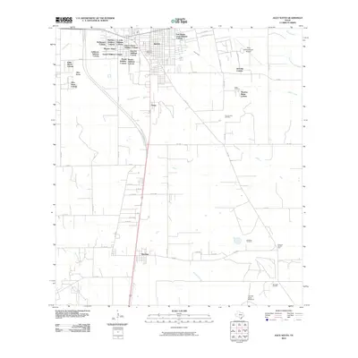
2010 Map of Alice South
USGS Topo · Published 2010About this map
Alice serves as the hub of this South Texas landscape, where the transition from urban streets to sprawling rural land is marked by numerous residential developments known as colonias. These include Rancho Alegre, Alice Acres, and the Mayes Addition Colonia, reflecting a specific pattern of settlement and growth on the city's periphery. To the south, the community of Ben Bolt sits along the primary highway corridor, separated from the main city by a network of ranch roads and oil infrastructure.
Find a feature on this map
63 named features on this map. Tap any name to fly to it.
Don’t see what you’re looking for? This feature index may not catch every label — zoom into the map to look around manually.
Map Details
Editions of this 2010 Alice South Map
This is the sole edition of this map. No revisions or reprints were ever made.
Other maps of this area

1917 · Ben Bolt
USGS Topo · 1:62,500

1920 · San Diego
USGS Topo · 1:62,500

1950 · Corpus Christi
USGS Topo · 1:250,000

1954 · Orange Grove
USGS Topo · 1:62,500

1954 · Kingsville
USGS Topo · 1:62,500

1956 · Corpus Christi
USGS Topo · 1:250,000

1956 · Laredo
USGS Topo · 1:250,000

1960 · Corpus Christi
USGS Topo · 1:250,000

1963 · Ben Bolt SE
USGS Topo · 1:24,000

1963 · San Diego
USGS Topo · 1:24,000