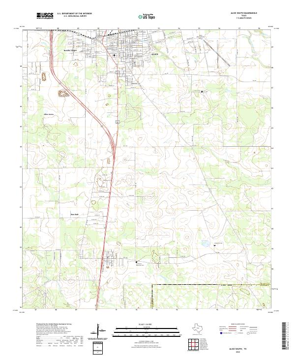
2022 Map of Alice South
USGS Topo · Published 2022About this map
Alice and its surrounding agricultural outskirts dominate this Jim Wells County landscape, where urban street grids meet the sprawling ranches of the Texas coastal plains. The transit network is anchored by US Hwy 281, which serves as a central artery connecting the primary settlement to outlying residential pockets like Rancho Alegre and Alice Acres. In the northeast, the Alice International Airport stands as a significant landmark, marking the area's role as a regional transportation hub.
Find a feature on this map
118 named features on this map. Tap any name to fly to it.
Don’t see what you’re looking for? This feature index may not catch every label — zoom into the map to look around manually.
Map Details
Editions of this 2022 Alice South Map
This is the sole edition of this map. No revisions or reprints were ever made.
Other maps of this area

1917 · Ben Bolt
USGS Topo · 1:62,500

1920 · San Diego
USGS Topo · 1:62,500

1950 · Corpus Christi
USGS Topo · 1:250,000

1954 · Orange Grove
USGS Topo · 1:62,500

1954 · Kingsville
USGS Topo · 1:62,500

1956 · Corpus Christi
USGS Topo · 1:250,000

1956 · Laredo
USGS Topo · 1:250,000

1960 · Corpus Christi
USGS Topo · 1:250,000

1963 · Ben Bolt SE
USGS Topo · 1:24,000

1963 · San Diego
USGS Topo · 1:24,000