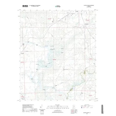
2018 Map of Aliceville South
USGS Topo · Published 2018About this map
The Tombigbee River and the engineered Tennessee-Tombigbee Waterway dominate the landscape of the Alabama-Mississippi borderlands, winding through a complex of bars and shoals. This low-lying riverine environment is defined by its seasonal hydrology, where features like Dead River and Big Slough branch off from the main channel near Summerville Bar and Vienna Bar. The human footprint is most evident in established settlements like Aliceville and Vienna, which sit elevated above the floodplain.
Find a feature on this map
70 named features on this map. Tap any name to fly to it.
Don’t see what you’re looking for? This feature index may not catch every label — zoom into the map to look around manually.
Map Details
Editions of this 2018 Aliceville South Map
This is the sole edition of this map. No revisions or reprints were ever made.
Other maps of this area

1953 · Meridian
USGS Topo · 1:250,000

1953 · West Point
USGS Topo · 1:250,000

1957 · Meridian
USGS Topo · 1:250,000

1958 · West Point
USGS Topo · 1:250,000

1963 · West Point
USGS Topo · 1:250,000

1965 · Meridian
USGS Topo · 1:250,000

1970 · Aliceville North
USGS Topo · 1:24,000
1970 · Cunningham
USGS Topo · 1:24,000
1970 · Pleasant Ridge
USGS Topo · 1:24,000
1970 · West Greene
USGS Topo · 1:24,000