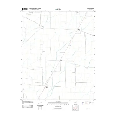
2011 Map of Alicia
USGS Topo · Published 2011About this map
Alicia and Minturn anchor this agricultural region along the corridor of U.S. Route 67, where the terrain is defined by a complex network of drainage ditches and sloughs. The landscape reflects a legacy of water management, with Big Running Water Creek and Village Creek flanked by smaller waterways such as Black Spice Ditch and Maple Ditch. These systems are essential to the vast farming plots that dominate the area, intersected by a dense grid of local thoroughfares like Lawrence Road 547 and Jackson Road 699.
Find a feature on this map
45 named features on this map. Tap any name to fly to it.
Don’t see what you’re looking for? This feature index may not catch every label — zoom into the map to look around manually.
Map Details
Editions of this 2011 Alicia Map
This is the sole edition of this map. No revisions or reprints were ever made.
Other maps of this area

1932 · Walnut Ridge
USGS Topo · 1:62,500

1934 · Powhatan
USGS Topo · 1:62,500

1935 · Powhatan
USGS Topo · 1:62,500

1935 · Sedgwick
USGS Topo · 1:62,500

1935 · Alicia
USGS Topo · 1:62,500

1935 · Walnut Ridge
USGS Topo · 1:62,500

1953 · Memphis
USGS Topo · 1:250,000

1956 · Memphis
USGS Topo · 1:250,000

1957 · Poplar Bluff
USGS Topo · 1:250,000

1959 · Poplar Bluff
USGS Topo · 1:250,000