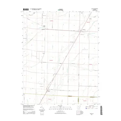
2014 Map of Alicia
USGS Topo · Published 2014About this map
Clover Bend and the surrounding agricultural lowlands of Lawrence County define this landscape, where the meandering course of Big Running Water Cr meets an extensive network of drainage ditches and sloughs. This territory is characterized by its rural settlement pattern, with small communities like Hopewell, Calvin, and Lindsey connected by a grid of county roads and the diagonal corridor of Us-67. The town of Alicia anchors the southern portion of the map at the junction of Ar-230, showing a concentrated residential core. For genealogists and local historians, the map preserves the locations of several family and community burial grounds, including Clover Bend Cem, Covington Cem, and Miller Cem. The intricate hydrology, featuring Village Creek and Marrow Bone Slough, illustrates the persistent efforts to manage the wetlands of the Black River basin for cultivation.
Find a feature on this map
66 named features on this map. Tap any name to fly to it.
Don’t see what you’re looking for? This feature index may not catch every label — zoom into the map to look around manually.
Map Details
Editions of this 2014 Alicia Map
This is the sole edition of this map. No revisions or reprints were ever made.
Other maps of this area

1932 · Walnut Ridge
USGS Topo · 1:62,500

1934 · Powhatan
USGS Topo · 1:62,500

1935 · Powhatan
USGS Topo · 1:62,500

1935 · Sedgwick
USGS Topo · 1:62,500

1935 · Alicia
USGS Topo · 1:62,500

1935 · Walnut Ridge
USGS Topo · 1:62,500

1953 · Memphis
USGS Topo · 1:250,000

1956 · Memphis
USGS Topo · 1:250,000

1957 · Poplar Bluff
USGS Topo · 1:250,000

1959 · Poplar Bluff
USGS Topo · 1:250,000