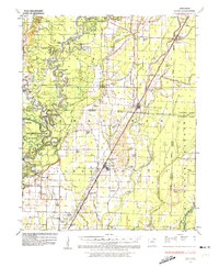
1935 Map of Alicia
USGS Topo · Published 1974About this map
The Black River meanders through a landscape defined by dramatic horseshoe loops and river-bottom landings in the mid-1930s. This survey by the War Department and Corps of Engineers documents the winding corridor through Lawrence and Jackson Counties, where river crossings like Whitelow Ferry and Lockheart Ferry remained vital. The terrain is marked by numerous named bends, including Red Fox Bend and Stallings Bend, and historically significant sites such as the Old Martin Mill Place.
Find a feature on this map
88 named features on this map. Tap any name to fly to it.
Don’t see what you’re looking for? This feature index may not catch every label — zoom into the map to look around manually.
Map Details
Editions of this 1935 Alicia Map
3 editions found
Other maps of this area

1932 · Strawberry
USGS Topo · 1:62,500

1932 · Walnut Ridge
USGS Topo · 1:62,500

1934 · Powhatan
USGS Topo · 1:62,500

1935 · Powhatan
USGS Topo · 1:62,500

1935 · Sedgwick
USGS Topo · 1:62,500

1935 · Alicia
USGS Topo · 1:62,500

1935 · Strawberry
USGS Topo · 1:62,500

1935 · Newport
USGS Topo · 1:62,500

1935 · Tuckerman
USGS Topo · 1:62,500

1935 · Walnut Ridge
USGS Topo · 1:62,500