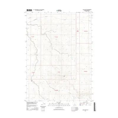
2015 Map of Alkali Butte
USGS Topo · Published 2015About this map
Alkali Butte rises as a prominent landmark in this section of Fremont County, anchoring a landscape shaped by drainage systems and industrial access roads. The map reveals the winding path of Alkali Cr as it traverses the central and northern portions of the quadrangle, alongside the smaller Carter Draw. Transport in this arid terrain is defined by specialized routes like Gas Hills Rd, Riverton Gas Hills Rd, and Oil Springs Rd, which serve as critical infrastructure for the region's energy and ranching interests. These roads navigate the complex township and range divisions, connecting remote drainage basins and high-desert terrain during a period of modern land management and resource extraction in central Wyoming.
Find a feature on this map
14 named features on this map. Tap any name to fly to it.
Don’t see what you’re looking for? This feature index may not catch every label — zoom into the map to look around manually.
Map Details
Editions of this 2015 Alkali Butte Map
This is the sole edition of this map. No revisions or reprints were ever made.
Other maps of this area

1950 · Riverton East
USGS Topo · 1:24,000

1951 · Fuller Reservoir
USGS Topo · 1:24,000

1951 · Indian Butte
USGS Topo · 1:24,000

1953 · Blue Gulch
USGS Topo · 1:24,000

1953 · Arapahoe NE
USGS Topo · 1:24,000

1953 · Bringolf Ranch
USGS Topo · 1:24,000

1953 · Campbell Ridge
USGS Topo · 1:24,000

1953 · Sand Draw
USGS Topo · 1:24,000

1955 · Thermopolis
USGS Topo · 1:250,000

1955 · Lander
USGS Topo · 1:250,000