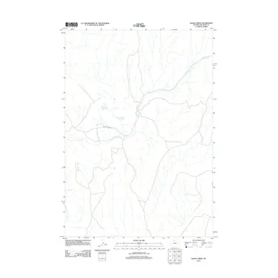
2012 Map of Alkali Creek
USGS Topo · Published 2012About this map
Crystal Cr carves a winding path through this portion of Big Horn County, defining the drainage patterns and topography of the high plains landscape. Water management is a central theme of this 2012 survey, as seen in the remote Bethurem Reservoir and the Brown Number 1 Reservoir. These small impoundments, characteristic of Western rangeland, represent essential infrastructure for livestock and local land use. Access through the drainage is primarily provided by Crystal Creek Rd, the lone primary road through this otherwise quiet and open terrain. The map captures the delicate balance of water resources in a region where surface water is the primary driver of human activity and ranching operations.
Find a feature on this map
4 named features on this map. Tap any name to fly to it.
Don’t see what you’re looking for? This feature index may not catch every label — zoom into the map to look around manually.
Map Details
Editions of this 2012 Alkali Creek Map
This is the sole edition of this map. No revisions or reprints were ever made.
Other maps of this area

1898 · Bald Mountain
USGS Topo · 1:125,000

1901 · Bald Mountain
USGS Topo · 1:125,000

1955 · Cody
USGS Topo · 1:250,000

1955 · Sheridan
USGS Topo · 1:250,000

1958 · Cody
USGS Topo · 1:250,000

1958 · Sheridan
USGS Topo · 1:250,000

1960 · Medicine Wheel
USGS Topo · 1:24,000

1960 · Devils Kitchen
USGS Topo · 1:24,000

1960 · Bear Creek Ranch
USGS Topo · 1:24,000

1962 · Sheridan
USGS Topo · 1:250,000