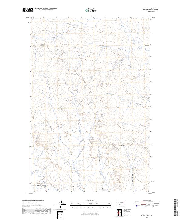
2024 Map of Alkali Creek
USGS Topo · Published 2024About this map
Angela serves as the primary point of settlement in this northern Rosebud County landscape, situated where the high plains are carved by a complex network of drainage systems. The terrain is defined by the winding course of Alkali Creek and its tributaries, reflecting the traditional ranching geography of eastern Montana. These waterways, including Lone Tree Creek and Hay Creek, dictate the movement across the land, with S Angela Rd providing the main thoroughfare through the northern sections.
Find a feature on this map
13 named features on this map. Tap any name to fly to it.
Don’t see what you’re looking for? This feature index may not catch every label — zoom into the map to look around manually.
Map Details
Editions of this 2024 Alkali Creek Map
This is the sole edition of this map. No revisions or reprints were ever made.
Other maps of this area

1954 · Forsyth
USGS Topo · 1:250,000

1957 · Forsyth
USGS Topo · 1:250,000

1958 · Forsyth
USGS Topo · 1:250,000

1965 · Rock Springs School
USGS Topo · 1:24,000

1965 · Clear Water Reservoir
USGS Topo · 1:24,000
1965 · Red Buttes
USGS Topo · 1:24,000

1969 · Van Burton Creek
USGS Topo · 1:24,000

1969 · Wild Horse Pass SE
USGS Topo · 1:24,000

1969 · Wild Horse Pass
USGS Topo · 1:24,000
1969 · Alkali Creek
USGS Topo · 1:24,000