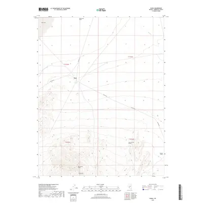
2018 Map of Alkali
USGS Topo · Published 2018About this map
Alkali occupies a high desert basin in Esmeralda County, centered near the therapeutic waters of Alkali Hot Spring. The landscape transitions from the broad, arid expanse of the Montezuma Valley and Alkali Lake in the north toward the rising elevations of the Montezuma Range and Flattop Mtn in the south. This remote high-desert environment is characterized by large-scale topographic features like Indian Springs Canyon and the edge of the Ralston Desert. Transportation and infrastructure are represented by the long stretch of Silver Peak Rd and the prominent Powerline Rd, which cut through the open country. The map captures a moment in the modern era where the sparse settlement pattern remains defined by its geologic and hydrological features.
Find a feature on this map
15 named features on this map. Tap any name to fly to it.
Don’t see what you’re looking for? This feature index may not catch every label — zoom into the map to look around manually.
Map Details
Editions of this 2018 Alkali Map
This is the sole edition of this map. No revisions or reprints were ever made.
Other maps of this area

1908 · Lida
USGS Topo · 1:250,000

1913 · Lida
USGS Topo · 1:250,000

1945 · Goldfield
USGS Topo · 1:125,000

1952 · Mud Lake
USGS Topo · 1:62,500

1952 · Goldfield
USGS Topo · 1:62,500

1954 · Goldfield
USGS Topo · 1:250,000

1955 · Goldfield
USGS Topo · 1:250,000

1958 · Goldfield
USGS Topo · 1:250,000

1962 · Goldfield
USGS Topo · 1:250,000
1970 · Klondike
USGS Topo · 1:24,000