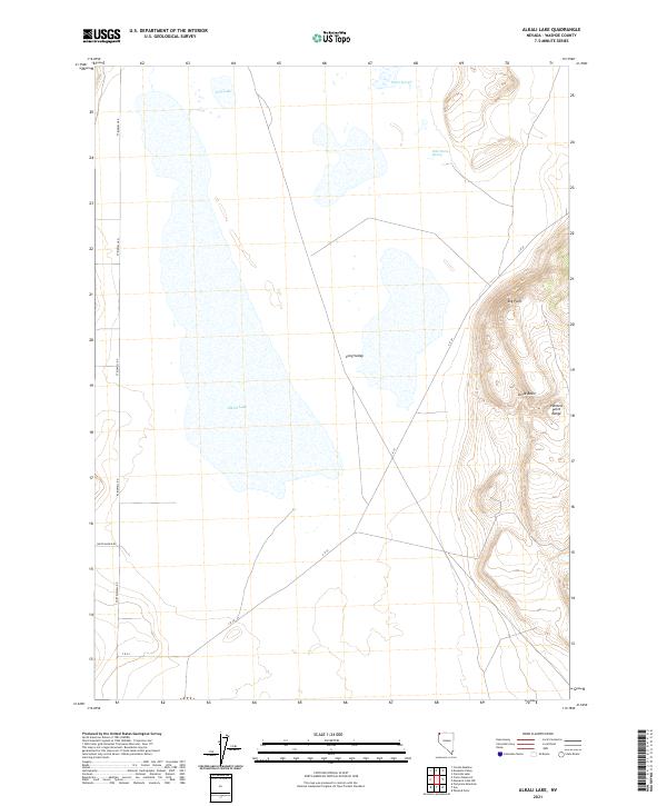
2021 Map of Alkali Lake
USGS Topo · Published 2021About this map
Alkali Lake dominates the central basin of this high-desert landscape in northern Washoe County, a characteristic seasonal water body surrounded by the expansive drainage of Long Valley. This 2021 survey details a region defined by its hydrogeology, where thermal features like Warm Springs and Hills Warm Spring emerge near the edges of the valley floor. The geography is bounded to the east by the dramatic elevations of the Painted Point Range, featuring prominent overlooks such as Big Point and the geological indentation of Little Basin. Movement through this remote terrain is dictated by long-established routes, including Ft Bidwell Rd and Smith Ranch Rd, which follow the natural contours of the basin. The map illustrates a classic Great Basin environment where water, though ephemeral as seen at Dry Lake, remains the primary factor for settlement and ranching access.
Find a feature on this map
15 named features on this map. Tap any name to fly to it.
Don’t see what you’re looking for? This feature index may not catch every label — zoom into the map to look around manually.
Map Details
Editions of this 2021 Alkali Lake Map
This is the sole edition of this map. No revisions or reprints were ever made.
Other maps of this area

1889 · Long Valley
USGS Topo · 1:250,000

1954 · Vya
USGS Topo · 1:250,000

1958 · Vya
USGS Topo · 1:250,000

1962 · Vya
USGS Topo · 1:250,000

1966 · Massacre Lake NW
USGS Topo · 1:24,000

1966 · Vya
USGS Topo · 1:24,000
1966 · Mosquito Valley
USGS Topo · 1:24,000
1966 · Calcutta Lake
USGS Topo · 1:24,000
1966 · Carter Reservoir
USGS Topo · 1:24,000

1966 · Alkali Lake
USGS Topo · 1:24,000