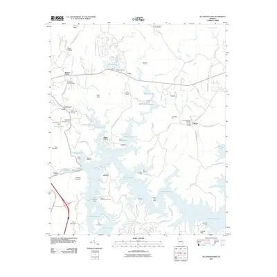
2011 Map of Allatoona Dam
USGS Topo · Published 2011About this map
Allatoona Lake dominates this landscape, its sprawling shoreline creating a complex geography of inlets and peninsulas defined by the flooding of the Etowah River valley. The Etowah River Dam and Powerhouse stands as the central engineering feature, reshaping the local economy and environment from its previous riverine state. Around the margins of the lake, older settlement patterns remain visible through a high concentration of family and church burial grounds, such as the Corbin-Kay Family Cemetery and the Leachman-Johnsey Family Cemetery. These sites, along with the Old Macedonia Cemetery (Old), provide significant genealogical anchors to the communities of Corbin, Holly Spring, and Laffingal. Industry and recreation meet here, evidenced by the Bartow County Quarry and the numerous campgrounds and landings like Galts Ferry Landing and Cooper Branch Landing. The terrain is characterized by prominent heights including Vineyard Mountain and Red Top Mountain, which frame the deep waters of the reservoir.
Find a feature on this map
102 named features on this map. Tap any name to fly to it.
Don’t see what you’re looking for? This feature index may not catch every label — zoom into the map to look around manually.
Map Details
Editions of this 2011 Allatoona Dam Map
This is the sole edition of this map. No revisions or reprints were ever made.
Other maps of this area

1890 · Cartersville
USGS Topo · 1:125,000

1891 · Cartersville
USGS Topo · 1:125,000

1896 · Cartersville
USGS Topo · 1:125,000

1906 · Stilesboro
USGS Topo · 1:62,500

1907 · Acworth
USGS Topo · 1:62,500

1908 · Stilesboro
USGS Topo · 1:62,500

1909 · Acworth
USGS Topo · 1:62,500

1941 · Adairsville
USGS Topo · 1:62,500

1944 · Adairsville
USGS Topo · 1:62,500

1947 · Waleska
USGS Topo · 1:62,500