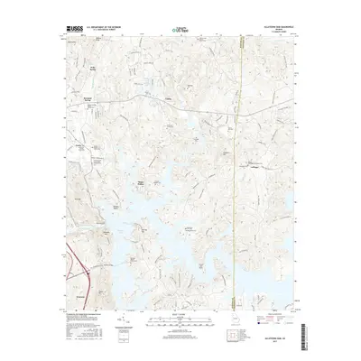
2017 Map of Allatoona Dam
USGS Topo · Published 2017About this map
Allatoona Lake dominates the southern half of this landscape, its fingers reaching deep into the forested valleys of the Etowah River drainage. The massive Allatoona Dam controls the waters, creating a shoreline where modern recreation at Red Top State Park and Bartow Beach sits alongside older, vanished footprints of regional industry and settlement. A rich collection of family and community burial grounds, such as the Alexander Cem, Shinall Cem, and the Macedonia Cem (Old) Old Macedonia Cem, provides a detailed record of the area's ancestral residents. The terrain is marked by significant rises including Signal Mtn and Pine Mtn, while the CSX Transportation line and 75 cut through the western edge near Emerson, marking the modern transit corridors that bypass the quiet interior hollows like Happy Hollow.
Find a feature on this map
128 named features on this map. Tap any name to fly to it.
Don’t see what you’re looking for? This feature index may not catch every label — zoom into the map to look around manually.
Map Details
Editions of this 2017 Allatoona Dam Map
This is the sole edition of this map. No revisions or reprints were ever made.
Other maps of this area

1890 · Cartersville
USGS Topo · 1:125,000

1891 · Cartersville
USGS Topo · 1:125,000

1896 · Cartersville
USGS Topo · 1:125,000

1906 · Stilesboro
USGS Topo · 1:62,500

1907 · Acworth
USGS Topo · 1:62,500

1908 · Stilesboro
USGS Topo · 1:62,500

1909 · Acworth
USGS Topo · 1:62,500

1941 · Adairsville
USGS Topo · 1:62,500

1944 · Adairsville
USGS Topo · 1:62,500

1947 · Waleska
USGS Topo · 1:62,500