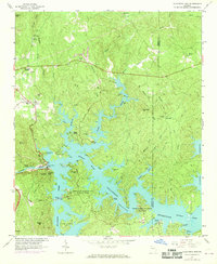
1968 Map of Allatoona Dam
USGS Topo · Published 1969About this map
Allatoona Dam stands as the central engineering feat on this landscape, holding back the waters of the Etowah River to form the expansive Allatoona Reservoir. The late 1960s revisions reveal a region transitioning into a premier recreation destination, with developments like Red Top Mountain State Park and George Washington Carver State Park flanking the shoreline. This period shows a complex interplay between newly flooded valleys and the remaining upland settlements like Corbin and Laffingal.
Find a feature on this map
62 named features on this map. Tap any name to fly to it.
Don’t see what you’re looking for? This feature index may not catch every label — zoom into the map to look around manually.
Map Details
Editions of this 1968 Allatoona Dam Map
This is the sole edition of this map. No revisions or reprints were ever made.
Other maps of this area

1890 · Cartersville
USGS Topo · 1:125,000

1891 · Cartersville
USGS Topo · 1:125,000

1896 · Cartersville
USGS Topo · 1:125,000

1906 · Stilesboro
USGS Topo · 1:62,500

1907 · Acworth
USGS Topo · 1:62,500

1908 · Stilesboro
USGS Topo · 1:62,500

1909 · Acworth
USGS Topo · 1:62,500

1941 · Adairsville
USGS Topo · 1:62,500

1944 · Adairsville
USGS Topo · 1:62,500

1947 · Waleska
USGS Topo · 1:62,500