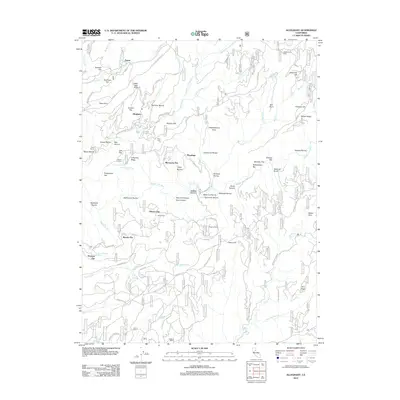
2012 Map of Alleghany
USGS Topo · Published 2012About this map
Alleghany sits at the heart of this Sierra County landscape, a terrain defined by the deep ravines and flat ridges characteristic of the California gold country. The map traces the winding course of the Middle Yuba River and Kanaka Cr, highlighting a complex network of 19th-century settlement sites and mining-era infrastructure. From the Mack House near Rapps Ravine to the agricultural traces of Malone Orchard, the sheet documents the transition from intensive resource extraction to a more dispersed rural character.
Find a feature on this map
98 named features on this map. Tap any name to fly to it.
Don’t see what you’re looking for? This feature index may not catch every label — zoom into the map to look around manually.
Map Details
Editions of this 2012 Alleghany Map
This is the sole edition of this map. No revisions or reprints were ever made.
Other maps of this area

1891 · Downieville
USGS Topo · 1:125,000

1891 · Colfax
USGS Topo · 1:125,000

1892 · Colfax
USGS Topo · 1:125,000

1893 · Downieville
USGS Topo · 1:125,000

1894 · Colfax
USGS Topo · 1:125,000

1895 · Downieville
USGS Topo · 1:125,000

1896 · Downieville
USGS Topo · 1:125,000

1897 · Downieville
USGS Topo · 1:125,000

1898 · Colfax
USGS Topo · 1:125,000

1900 · Colfax
USGS Topo · 1:125,000