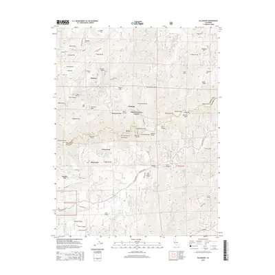
2015 Map of Alleghany
USGS Topo · Published 2015About this map
Alleghany and the surrounding mining district of the northern Sierra Nevada are documented in this detailed topographical study within the Tahoe National Forest. The landscape is defined by the deep incisions of the Middle Yuba River and its tributaries, such as Kanaka Cr and the ominously named Bloody Run. These drainages created the numerous ridges and flats that supported early settlement, including Moores Flat and Plumbago. Many of these locations, such as Minnesota Flat and Orleans Flat, represent the enduring footprint of hydraulic and lode mining operations in the region. The map also records a dense network of mountain roads like Graniteville Rd and Ridge Rd, which connect the isolated ravines of Jersey Ravine and Jackass Ravine to the broader regional infrastructure at the border of Sierra and Nevada counties.
Find a feature on this map
92 named features on this map. Tap any name to fly to it.
Don’t see what you’re looking for? This feature index may not catch every label — zoom into the map to look around manually.
Map Details
Editions of this 2015 Alleghany Map
This is the sole edition of this map. No revisions or reprints were ever made.
Other maps of this area

1891 · Downieville
USGS Topo · 1:125,000

1891 · Colfax
USGS Topo · 1:125,000

1892 · Colfax
USGS Topo · 1:125,000

1893 · Downieville
USGS Topo · 1:125,000

1894 · Colfax
USGS Topo · 1:125,000

1895 · Downieville
USGS Topo · 1:125,000

1896 · Downieville
USGS Topo · 1:125,000

1897 · Downieville
USGS Topo · 1:125,000

1898 · Colfax
USGS Topo · 1:125,000

1900 · Colfax
USGS Topo · 1:125,000