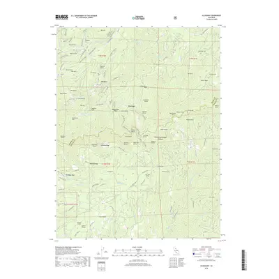
2018 Map of Alleghany
USGS Topo · Published 2018About this map
Alleghany serves as the central hub of this Sierra County landscape, where the geography is defined by the steep descents into the Middle Yuba River and Kanaka Cr. This modern survey reveals the persistent imprint of historical mining and timber infrastructure across the Tahoe National Forest, with numerous level benches or "flats" suggesting former sites of activity, including Minnesota Flat, Orleans Flat, and Moores Flat. The network of roads such as Henness Pass Rd and Plumbago Rd follows the high ridges, connecting the small settlement of Plumbago with more remote landmarks like American Hill. Steep ravines, from Jersey Ravine to the Golconda Ravine, score the mountainsides, illustrating the difficult terrain that historically defined the region's extraction industries. Water sources remain critical features of the topography, including numerous named springs like Mammoth Spring and Dempsey Springs.
Find a feature on this map
112 named features on this map. Tap any name to fly to it.
Don’t see what you’re looking for? This feature index may not catch every label — zoom into the map to look around manually.
Map Details
Editions of this 2018 Alleghany Map
This is the sole edition of this map. No revisions or reprints were ever made.
Other maps of this area

1891 · Downieville
USGS Topo · 1:125,000

1891 · Colfax
USGS Topo · 1:125,000

1892 · Colfax
USGS Topo · 1:125,000

1893 · Downieville
USGS Topo · 1:125,000

1894 · Colfax
USGS Topo · 1:125,000

1895 · Downieville
USGS Topo · 1:125,000

1896 · Downieville
USGS Topo · 1:125,000

1897 · Downieville
USGS Topo · 1:125,000

1898 · Colfax
USGS Topo · 1:125,000

1900 · Colfax
USGS Topo · 1:125,000