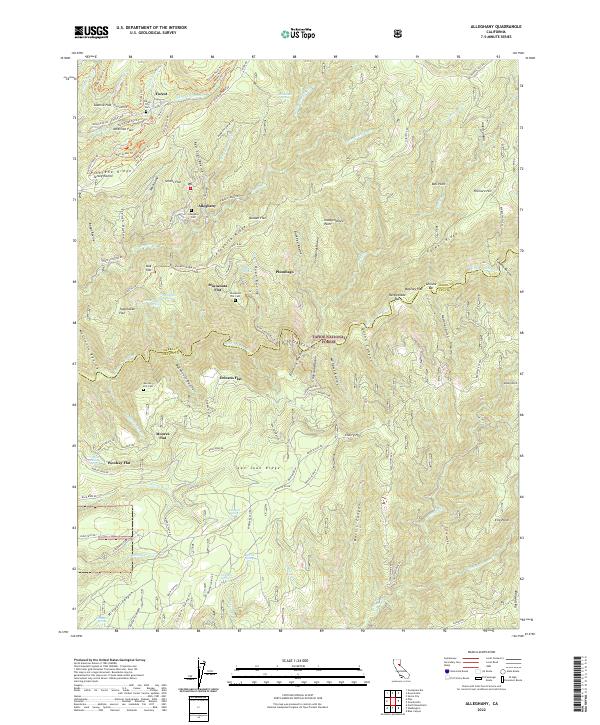
2022 Map of Alleghany
USGS Topo · Published 2022About this map
Alleghany serves as the central hub for a landscape defined by deep ravines and high ridges within the Tahoe National Forest. The map documents a historical footprint of gold-era activity, evidenced by the numerous cemeteries including the Forest City Cem and Minnesota Flat Cem, which sit atop hillsides once bustling with hydraulic and hard-rock mining. Settlement patterns follow the topography of the benches or flats, such as Moores Flat and Orleans Flat, which overlook the steep drainage of the Middle Yuba River. Transportation is shaped by the complex terrain, with routes like the Foote Crossing Rd and the Pliocene Ridge Rd connecting these remote outposts. The network of water management features, including the Plum Valley Ditch Trl and Irwin Ditch Rd, illustrates the intensive effort to redirect water across San Juan Ridge for industrial use.
Find a feature on this map
108 named features on this map. Tap any name to fly to it.
Don’t see what you’re looking for? This feature index may not catch every label — zoom into the map to look around manually.
Map Details
Editions of this 2022 Alleghany Map
This is the sole edition of this map. No revisions or reprints were ever made.
Other maps of this area

1891 · Downieville
USGS Topo · 1:125,000

1891 · Colfax
USGS Topo · 1:125,000

1892 · Colfax
USGS Topo · 1:125,000

1893 · Downieville
USGS Topo · 1:125,000

1894 · Colfax
USGS Topo · 1:125,000

1895 · Downieville
USGS Topo · 1:125,000

1896 · Downieville
USGS Topo · 1:125,000

1897 · Downieville
USGS Topo · 1:125,000

1898 · Colfax
USGS Topo · 1:125,000

1900 · Colfax
USGS Topo · 1:125,000