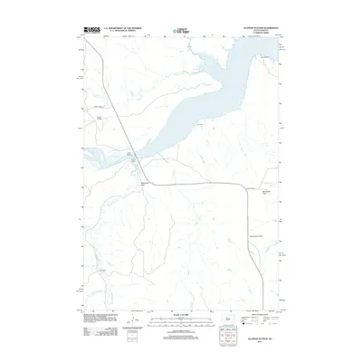
2012 Map of Alleman Station
USGS Topo · Published 2012About this map
Lake Oahe dominates the central landscape of this West River South Dakota survey, its vast waters filling the Missouri River basin and creating a complex network of inlets and arms. The topographic detail captures the intersection of water and ranching life, highlighting named cattle operations such as the Pearman Ranch to the north and Carr Ranch on the eastern bluffs. Near the western shore, Alleman Station and the Carlin Bridge provide essential transit points across the rugged draws and breaks that drain into the reservoir.
Find a feature on this map
18 named features on this map. Tap any name to fly to it.
Don’t see what you’re looking for? This feature index may not catch every label — zoom into the map to look around manually.
Map Details
Editions of this 2012 Alleman Station Map
This is the sole edition of this map. No revisions or reprints were ever made.
Other maps of this area

1954 · Pierre
USGS Topo · 1:250,000

1956 · Kirley
USGS Topo · 1:24,000

1956 · Carlin Flat
USGS Topo · 1:24,000

1956 · Alleman Station
USGS Topo · 1:24,000

1956 · Herbert Creek SE
USGS Topo · 1:24,000

1956 · Sansarc NE
USGS Topo · 1:24,000

1958 · Pierre
USGS Topo · 1:250,000

1981 · Herbert Creek SW
USGS Topo · 1:24,000

1981 · High Elk Hill SE
USGS Topo · 1:24,000

1982 · Sansarc
USGS Topo · 1:24,000