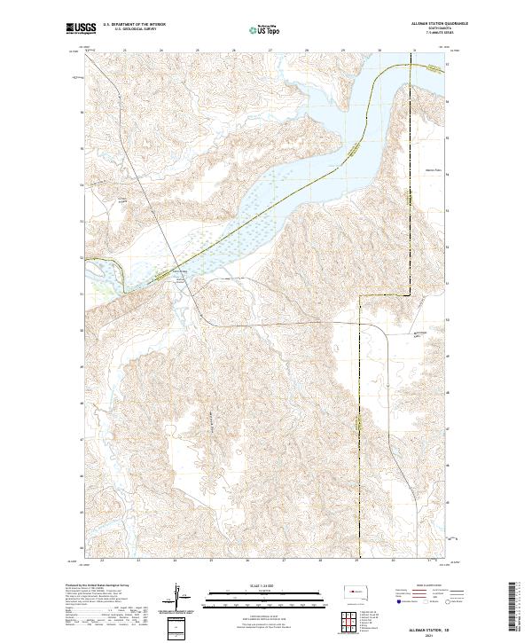
2021 Map of Alleman Station
USGS Topo · Published 2021About this map
Alleman Station sits at a critical geographic junction where the Cheyenne River meets the expansive waters of Lake Oahe. This 2021 survey illustrates the complex hydrology of the Missouri River Basin, where numerous tributaries like Dupree Cr, Sage Cr, and Hermaphrodite Cr carve through the landscape to join the primary waterway. The terrain is defined by distinct elevated level areas, notably Circle P Flats and Mississippi Flats, which reflect the region's ranching character and open range geography. Transportation across these vast reaches is facilitated by the Carlin Bridge and local connectors like Cherry Creek Rd. The map also traces intricate county boundaries where Ziebach, Haakon, Stanley, and Dewey counties converge, highlighting the administrative complexity of this central South Dakota river corridor.
Find a feature on this map
22 named features on this map. Tap any name to fly to it.
Don’t see what you’re looking for? This feature index may not catch every label — zoom into the map to look around manually.
Map Details
Editions of this 2021 Alleman Station Map
This is the sole edition of this map. No revisions or reprints were ever made.
Other maps of this area

1954 · Pierre
USGS Topo · 1:250,000

1956 · Kirley
USGS Topo · 1:24,000

1956 · Carlin Flat
USGS Topo · 1:24,000

1956 · Alleman Station
USGS Topo · 1:24,000

1956 · Herbert Creek SE
USGS Topo · 1:24,000

1956 · Sansarc NE
USGS Topo · 1:24,000

1958 · Pierre
USGS Topo · 1:250,000

1981 · Herbert Creek SW
USGS Topo · 1:24,000

1981 · High Elk Hill SE
USGS Topo · 1:24,000

1982 · Sansarc
USGS Topo · 1:24,000