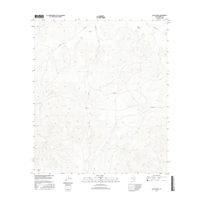
2016 Map of Allen Ranch
USGS Topo · Published 2016About this map
Allen Ranch sits at the heart of this dryland terrain in Terrell County, illustrating the isolated ranching infrastructure of west Texas in the early 21st century. The landscape is defined by the significant incision of Big Canyon in the north and the expansive Downie Draw to the southwest, features that dictate the sparse network of unpaved access routes. These primitive roads, including Walker Rd and Hardgrove Rd, follow the natural contours of the high desert plateau. This 2016 survey by the U.S. Geological Survey captures a specific moment in the land management of the region, where family-named roads like Allen Rd and Hardgrave Rd serve as the primary links between remote ranching outposts and the wider county.
Find a feature on this map
8 named features on this map. Tap any name to fly to it.
Don’t see what you’re looking for? This feature index may not catch every label — zoom into the map to look around manually.
Map Details
Editions of this 2016 Allen Ranch Map
This is the sole edition of this map. No revisions or reprints were ever made.
Other maps of this area

1928 · Sanderson
USGS Topo · 1:125,000

1954 · Fort Stockton
USGS Topo · 1:250,000

1958 · Fort Stockton
USGS Topo · 1:250,000

1969 · Circle Dot Ranch
USGS Topo · 1:24,000

1969 · Big Canyon Ranch
USGS Topo · 1:24,000

1969 · Continental Ranch
USGS Topo · 1:24,000

1969 · Circle Dot Ranch NE
USGS Topo · 1:24,000

1969 · Dryden NE
USGS Topo · 1:24,000

1969 · Dryden NW
USGS Topo · 1:24,000
1969 · Sanderson NE
USGS Topo · 1:24,000