
1969 Map of Circle Dot Ranch NE
USGS Topo · Published 1972About this map
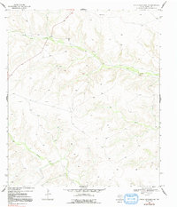
Mitchell Ranch serves as a primary human landmark in this section of Terrell County during the late 1960s. The landscape is defined by the drainage patterns of Dry Creek and McKay Creek, which carve through the high desert terrain. The presence of a Gas Well and an Oil Well, connected by a traversing Pipeline, illustrates the subterranean industrial activity that quietly shaped this part of West Texas. Named elevations such as Mitchell, Center, and Rit provide topographical reference points across a vast network of contours. This map captures a specific moment in the ranching and mineral extraction history of the region, showing the sparse infrastructure and remote nature of the terrain before later developments. The meticulous detail of the surveying highlights how watercourses like Dry Creek dictated the placement of early roads and ranch sites.
Find a feature on this map
9 named features on this map. Tap any name to fly to it.
Don’t see what you’re looking for? This feature index may not catch every label — zoom into the map to look around manually.
Map Details
Editions of this 1969 Circle Dot Ranch NE Map
2 editions found
Other maps of this area

1928 · Sanderson
USGS Topo · 1:125,000

1929 · Sheffield
USGS Topo · 1:125,000

1929 · Independence Draw Quadrangle
USGS Topo · 1:125,000

1954 · Fort Stockton
USGS Topo · 1:250,000

1954 · Sonora
USGS Topo · 1:250,000

1958 · Sonora
USGS Topo · 1:250,000

1958 · Fort Stockton
USGS Topo · 1:250,000

1967 · Horsehead Canyon
USGS Topo · 1:24,000

1969 · Circle Dot Ranch
USGS Topo · 1:24,000

1969 · Continental Ranch
USGS Topo · 1:24,000