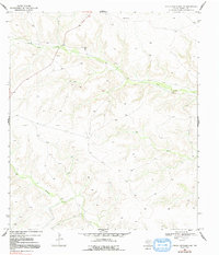
1969 Map of Circle Dot Ranch NE
USGS Topo · Published 1991About this map
Dry plateaus and deeply carved drainages characterize this West Texas landscape in the late 1960s, a terrain defined by intermittent watercourses like Dry Creek and McKay Creek. The solitary presence of Mitchell Ranch suggests the vast distances between homesteads in this portion of Terrell County, where ranching and energy extraction are the primary human imprints. Evidence of the region's petroleum industry is visible through a Gas Well, an Oil Well, and a prominent Pipeline crossing the northern terrain. Named topographic points such as Mitchell, Center, and Rit serve as the few navigational markers across these high elevations. This survey reflects a moment before significant modern development, showing the area as it existed when topographic mapping was largely conducted via aerial photography and field checking by the Geological Survey.
Find a feature on this map
9 named features on this map. Tap any name to fly to it.
Don’t see what you’re looking for? This feature index may not catch every label — zoom into the map to look around manually.
Map Details
Editions of this 1969 Circle Dot Ranch NE Map
2 editions found

Other maps of this area

1928 · Sanderson
USGS Topo · 1:125,000

1929 · Sheffield
USGS Topo · 1:125,000

1929 · Independence Draw Quadrangle
USGS Topo · 1:125,000

1954 · Fort Stockton
USGS Topo · 1:250,000

1954 · Sonora
USGS Topo · 1:250,000

1958 · Sonora
USGS Topo · 1:250,000

1958 · Fort Stockton
USGS Topo · 1:250,000

1967 · Horsehead Canyon
USGS Topo · 1:24,000

1969 · Circle Dot Ranch
USGS Topo · 1:24,000

1969 · Continental Ranch
USGS Topo · 1:24,000