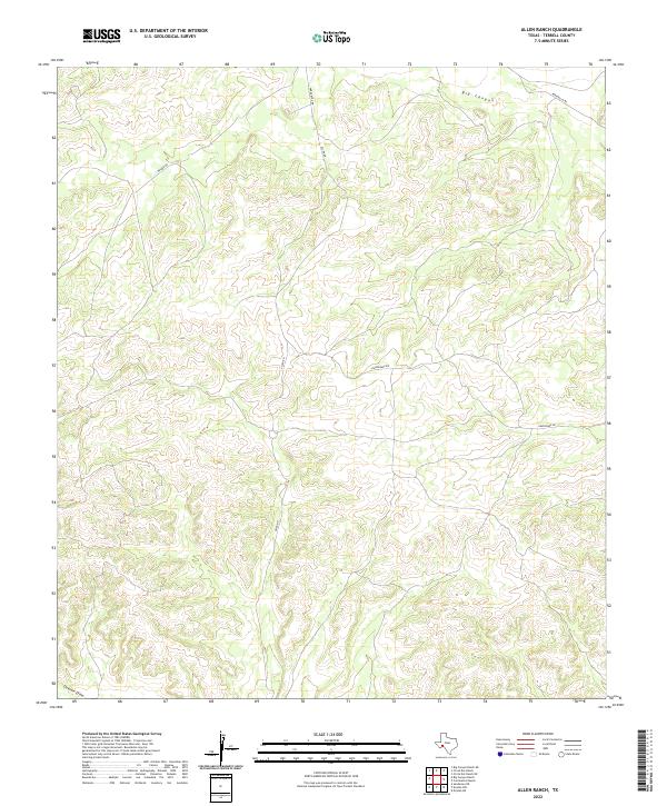
2022 Map of Allen Ranch
USGS Topo · Published 2022About this map
Big Canyon dominates the northern landscape of this Terrell County region, carved through the arid high country of West Texas. The terrain is defined by a dense network of drainage patterns and draws that funnel toward the south, including the prominent Downie Draw in the southwestern corner. This area is characterized by large-scale ranching and remote infrastructure, where transportation is limited to established thoroughfares such as Walker Rd and Hardgrove Rd. The map illustrates the sparsely populated nature of the Edwards Plateau transition, with widely dispersed tracks like Allen Rd and Running W Rd providing the only terrestrial access across the dissected plateaus. The topography reveals the complex erosional history of the Trans-Pecos, where elevation changes are sharp and closely tied to the seasonal watercourses that define the county's physical geography.
Find a feature on this map
8 named features on this map. Tap any name to fly to it.
Don’t see what you’re looking for? This feature index may not catch every label — zoom into the map to look around manually.
Map Details
Editions of this 2022 Allen Ranch Map
This is the sole edition of this map. No revisions or reprints were ever made.
Other maps of this area

1928 · Sanderson
USGS Topo · 1:125,000

1954 · Fort Stockton
USGS Topo · 1:250,000

1958 · Fort Stockton
USGS Topo · 1:250,000

1969 · Circle Dot Ranch
USGS Topo · 1:24,000

1969 · Big Canyon Ranch
USGS Topo · 1:24,000

1969 · Continental Ranch
USGS Topo · 1:24,000

1969 · Circle Dot Ranch NE
USGS Topo · 1:24,000

1969 · Dryden NE
USGS Topo · 1:24,000

1969 · Dryden NW
USGS Topo · 1:24,000
1969 · Sanderson NE
USGS Topo · 1:24,000