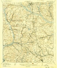
1919 Map of Allendale
USGS Topo · Published 1942About this map
Barnwell and Allendale serve as the primary hubs in this region of South Carolina during the late 1910s, connected by a network of railways including the Atlantic Coast Line and the Southern. The landscape is defined by the winding course of the Salkehatchie River and numerous smaller water bodies such as Green Savanna Lake and Fiddle Pond. Rural life is anchored by a high density of community centers, from Hagoods Mill to a significant concentration of country churches like New Hope Church, Smyrna Church, and Beautiful Gate Church.
Find a feature on this map
66 named features on this map. Tap any name to fly to it.
Don’t see what you’re looking for? This feature index may not catch every label — zoom into the map to look around manually.
Map Details
Editions of this 1919 Allendale Map
4 editions found
Other maps of this area

1918 · Varnville
USGS Topo · 1:62,500

1919 · Olar
USGS Topo · 1:62,500

1919 · Bamberg
USGS Topo · 1:48,000

1919 · Allendale
USGS Topo · 1:62,500

1920 · Ellenton
USGS Topo · 1:48,000

1920 · Hilltonia
USGS Topo · 1:62,500

1920 · Bamberg
USGS Topo · 1:62,500

1920 · Peeples
USGS Topo · 1:62,500

1920 · Talatha
USGS Topo · 1:48,000

1921 · Talatha
USGS Topo · 1:62,500