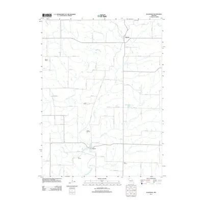
2011 Map of Allendale
USGS Topo · Published 2011About this map
East Fork Grand River winds through this rural Worth County landscape, serving as a primary drainage corridor for the settlements of Allendale and Denver. The terrain is defined by a dense network of country roads and numerous small tributaries such as Lotts Creek, Big Rock Creek, and Little Rock Creek. This modern survey reveals a quiet agricultural region where family history is anchored by several dispersed burial grounds, including Wharton Cemetery, Hoblett Cemetery, and Kirk Cemetery. Notable water features such as Bea Dunfee Lake and the Findley Lake Dam highlight local water management and recreation. The high point at Mount Waller provides a landmark for the western portion of the quadrangle, while the convergence of Martin Branch and Dawson Branch into the river system illustrates the watershed's complex geography.
Find a feature on this map
72 named features on this map. Tap any name to fly to it.
Don’t see what you’re looking for? This feature index may not catch every label — zoom into the map to look around manually.
Map Details
Editions of this 2011 Allendale Map
This is the sole edition of this map. No revisions or reprints were ever made.
Other maps of this area

1940 · Blockton
USGS Topo · 1:62,500

1942 · Grant City
USGS Topo · 1:62,500

1943 · Grant City
USGS Topo · 1:62,500

1943 · Blockton
USGS Topo · 1:62,500

1945 · Mount Ayr
USGS Topo · 1:62,500

1947 · Mount Ayr
USGS Topo · 1:62,500

1948 · Bethany
USGS Topo · 1:62,500

1955 · Nebraska City
USGS Topo · 1:250,000

1957 · Nebraska City
USGS Topo · 1:250,000

1958 · Nebraska City
USGS Topo · 1:250,000