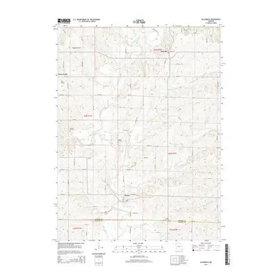
2014 Map of Allendale
USGS Topo · Published 2014About this map
Allendale and Denver serve as the primary focal points of this northern Missouri landscape, situated near the winding path of the East Fork Grand River. The terrain is defined by a dense network of tributaries including Wharton Br, Big Rock Cr, and Little Rock Cr, which carve through the countryside toward the Worth Co Gentry Co border. Local history is anchored by several small burial grounds such as Wharton Cemetery, Hoblett Cemetery, and Kent Cemetery, offering valuable data points for genealogical research in this rural region. The topography rises significantly at Mt Waller, providing a natural landmark over the surrounding agricultural sections. While the area is largely defined by its river-and-creek system, landmarks like Bea Dunfee Lake and numerous section roads like Rimrock Trl reflect the established rural infrastructure of the early 21st century.
Find a feature on this map
76 named features on this map. Tap any name to fly to it.
Don’t see what you’re looking for? This feature index may not catch every label — zoom into the map to look around manually.
Map Details
Editions of this 2014 Allendale Map
This is the sole edition of this map. No revisions or reprints were ever made.
Other maps of this area

1940 · Blockton
USGS Topo · 1:62,500

1942 · Grant City
USGS Topo · 1:62,500

1943 · Grant City
USGS Topo · 1:62,500

1943 · Blockton
USGS Topo · 1:62,500

1945 · Mount Ayr
USGS Topo · 1:62,500

1947 · Mount Ayr
USGS Topo · 1:62,500

1948 · Bethany
USGS Topo · 1:62,500

1955 · Nebraska City
USGS Topo · 1:250,000

1957 · Nebraska City
USGS Topo · 1:250,000

1958 · Nebraska City
USGS Topo · 1:250,000