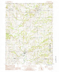
1984 Map of Allendale
USGS Topo · Published 1985About this map
Allendale and Denver are the primary settlements in this rural landscape near the border of Worth and Gentry counties. The topography is defined by the winding course of the Grand River and its major tributaries, including the East Fork Grand River and Lotts Creek. A significant portion of the eastern territory is dedicated to the Emmett and Leah Seat Memorial State Wildlife Area, indicating a region where natural conservation and traditional land use coexist. The map details numerous small drainages like Wharton Br and Big Rock Creek, which carve through the townships of Allen, Smith, and Fletchall. This 1980s survey captures the region's agricultural character, preserved in the road network and scattered rural dwellings that connect these historic river towns.
Find a feature on this map
22 named features on this map. Tap any name to fly to it.
Don’t see what you’re looking for? This feature index may not catch every label — zoom into the map to look around manually.
Map Details
Editions of this 1984 Allendale Map
This is the sole edition of this map. No revisions or reprints were ever made.
Other maps of this area

1940 · Blockton
USGS Topo · 1:62,500

1942 · Grant City
USGS Topo · 1:62,500

1943 · Grant City
USGS Topo · 1:62,500

1943 · Blockton
USGS Topo · 1:62,500

1945 · Mount Ayr
USGS Topo · 1:62,500

1947 · Mount Ayr
USGS Topo · 1:62,500

1948 · Bethany
USGS Topo · 1:62,500

1955 · Nebraska City
USGS Topo · 1:250,000

1957 · Nebraska City
USGS Topo · 1:250,000

1958 · Nebraska City
USGS Topo · 1:250,000