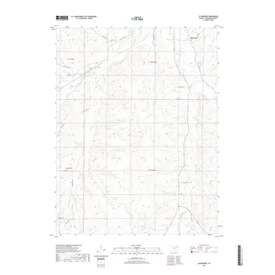
2018 Map of Allendorph
USGS Topo · Published 2018About this map
Allendorph anchors this section of Wabaunsee County, where the landscape is defined by the headwaters of several prominent creek branches. The intricate drainage network includes the W Br Mill Cr and S Br Mill Cr, which carve through the terrain alongside Illinois Cr and Loire Cr. This rural environment is connected by a web of named roads that hint at the area's local history and past usage, such as Poor Farm RD, Skyline Rd, and the curiously named Little Egypt Rd. Genealogists may find interest in the Fairview Cem located near Loire Creek Rd in the northern portion of the map. The map effectively documents the persistent rural character of the Flint Hills region, where land divisions follow the Public Land Survey System across Townships 12 and 13 South.
Find a feature on this map
25 named features on this map. Tap any name to fly to it.
Don’t see what you’re looking for? This feature index may not catch every label — zoom into the map to look around manually.
Map Details
Editions of this 2018 Allendorph Map
This is the sole edition of this map. No revisions or reprints were ever made.
Other maps of this area

1885 · Eskridge
USGS Topo · 1:125,000

1889 · Wamego
USGS Topo · 1:125,000

1889 · Eskridge
USGS Topo · 1:125,000

1894 · Eskridge
USGS Topo · 1:125,000

1894 · Wamego
USGS Topo · 1:125,000
1953 · Wamego SW
USGS Topo · 1:24,000

1954 · Alma
USGS Topo · 1:24,000

1954 · Mc Farland
USGS Topo · 1:24,000

1955 · Manhattan
USGS Topo · 1:250,000

1955 · Hutchinson
USGS Topo · 1:250,000