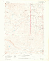
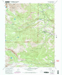
1957 Map of Allens Park
USGS Topo · Published 1968About this map
Allens Park and the neighboring community of Ferncliff serve as the primary gateways into the high-altitude wilderness of the Rocky Mountain National Park and Roosevelt National Forest during the mid-1950s. The landscape is defined by the complex drainage systems of St Vrain Creek and its many branches, including the Middle St Vrain Creek and North St Vrain Creek.
Find a feature on this map
53 named features on this map. Tap any name to fly to it.
Don’t see what you’re looking for? This feature index may not catch every label — zoom into the map to look around manually.
Map Details
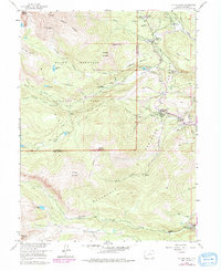
Editions of this 1957 Allens Park Map
7 editions found
Other maps of this area

1902 · Boulder
USGS Topo · 1:62,500

1904 · Boulder
USGS Topo · 1:62,500

1905 · Mount Olympus
USGS Topo · 1:62,500

1907 · Mount Olympus
USGS Topo · 1:62,500

1915 · Longs Peak
USGS Topo · 1:125,000

1919 · Rocky Mountain National Park
USGS Topo · 1:125,000

1954 · Greeley
USGS Topo · 1:250,000

1957 · Greeley
USGS Topo · 1:250,000

1957 · Mc Henrys Peak
USGS Topo · 1:24,000

1957 · Allens Park
USGS Topo · 1:24,000