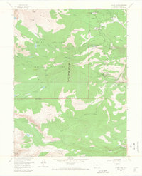
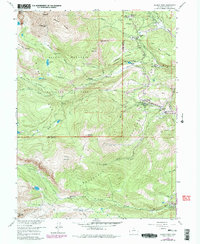
1957 Map of Allens Park
USGS Topo · Published 1968About this map
Allens Park serves as a central hub in this mid-century survey of the Front Range, where the eastern edge of Rocky Mountain National Park meets the Roosevelt National Forest. The map documents a landscape of high alpine peaks and lower-elevation settlements connected by a burgeoning network of trails and roads. Notable infrastructure of the era includes the Hydraulic Laboratory along the Roaring Fork and the Wild Basin Ranger Station, which managed access to the interior backcountry.
Find a feature on this map
61 named features on this map. Tap any name to fly to it.
Don’t see what you’re looking for? This feature index may not catch every label — zoom into the map to look around manually.
Map Details
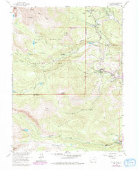
Editions of this 1957 Allens Park Map
7 editions found
Other maps of this area

1902 · Boulder
USGS Topo · 1:62,500

1904 · Boulder
USGS Topo · 1:62,500

1905 · Mount Olympus
USGS Topo · 1:62,500

1907 · Mount Olympus
USGS Topo · 1:62,500

1915 · Longs Peak
USGS Topo · 1:125,000

1919 · Rocky Mountain National Park
USGS Topo · 1:125,000

1954 · Greeley
USGS Topo · 1:250,000

1957 · Greeley
USGS Topo · 1:250,000

1957 · Mc Henrys Peak
USGS Topo · 1:24,000

1957 · Allens Park
USGS Topo · 1:24,000