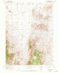
1947 Map of Allens Ranch
USGS Topo · Published 1970About this map
Allens Ranch sits at the base of the East Tintic Mountains, anchoring a landscape defined by livestock operations and early mid-century mineral extraction. This 1947 survey, with revisions updated in 1969, reveals a network of rough roads and trails traversing the southern Cedar Valley. The terrain is punctuated by significant volcanic and limestone formations including Bismark Peak and the prominent Wanlass Hill.
Find a feature on this map
22 named features on this map. Tap any name to fly to it.
Don’t see what you’re looking for? This feature index may not catch every label — zoom into the map to look around manually.
Map Details
Editions of this 1947 Allens Ranch Map
3 editions found
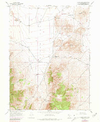
Other maps of this area

1885 · Salt Lake
USGS Topo · 1:250,000

1885 · Manti
USGS Topo · 1:250,000

1885 · Sevier Desert
USGS Topo · 1:250,000

1885 · Tooele Valley
USGS Topo · 1:250,000

1895 · Manti
USGS Topo · 1:250,000

1947 · Fivemile Pass
USGS Topo · 1:62,500

1947 · Allens Ranch
USGS Topo · 1:24,000

1947 · Boulter Peak
USGS Topo · 1:24,000

1947 · Goshen Pass
USGS Topo · 1:24,000

1949 · Eureka
USGS Topo · 1:24,000