
1950 Map of Allensville
USGS Topo · Published 1952About this map
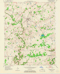
The Louisville and Nashville railroad tracks cut a diagonal path through this borderland, anchoring the primary settlement at Allensville. Situated in the fertile agricultural region where the Todd and Logan county lines meet the Tennessee border, the landscape is defined by the winding course of the Red River and its tributaries, including Elk Fork and Spring Creek. Small hamlets like Keysburg and Darnell provide a look at the rural post-war economy of the early 1950s, characterized by scattered family farmsteads and isolated landmarks such as Belmont Cem. The terrain reveals a complex network of drainage and local ponds, most notably Mosley Pond, which reflects the natural sinkhole topography of this limestone-heavy corridor.
Find a feature on this map
16 named features on this map. Tap any name to fly to it.
Don’t see what you’re looking for? This feature index may not catch every label — zoom into the map to look around manually.
Map Details
Editions of this 1950 Allensville Map
2 editions found
Other maps of this area

1950 · Guthrie
USGS Topo · 1:24,000

1950 · Olmstead
USGS Topo · 1:24,000

1951 · Elkton
USGS Topo · 1:24,000

1951 · Olmstead
USGS Topo · 1:24,000

1951 · Dot
USGS Topo · 1:24,000

1952 · Russellville
USGS Topo · 1:24,000

1952 · Springfield North
USGS Topo · 1:24,000

1956 · Nashville
USGS Topo · 1:250,000

1957 · Adams
USGS Topo · 1:24,000

1957 · Sango
USGS Topo · 1:24,000