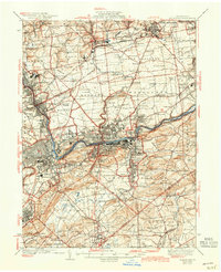
1939 Map of Allentown
USGS Topo · Published 1943About this map
The Lehigh River corridor in the mid-1930s serves as the industrial spine for this region, anchoring a dense network of iron and cement production. The landscape is defined by the heavy infrastructure of the C RR of NJ and L V RR, which connect the urban centers of Northampton, Catasauqua, and East Allentown. Evidence of the region’s specialized industry is found in the numerous quarries and the Cement Plant near Brodhead, reflecting the geological wealth that drove local development.
Find a feature on this map
148 named features on this map. Tap any name to fly to it.
Don’t see what you’re looking for? This feature index may not catch every label — zoom into the map to look around manually.
Map Details
Editions of this 1939 Allentown Map
4 editions found

Other maps of this area

1888 · Quakertown
USGS Topo · 1:62,500

1890 · Easton
USGS Topo · 1:62,500

1890 · Doylestown
USGS Topo · 1:62,500

1890 · Quakertown
USGS Topo · 1:62,500

1891 · Easton
USGS Topo · 1:62,500

1891 · Doylestown
USGS Topo · 1:62,500

1891 · Delaware Water Gap
USGS Topo · 1:62,500

1893 · Delaware Water Gap
USGS Topo · 1:62,500

1894 · Allentown
USGS Topo · 1:62,500

1894 · Quakertown
USGS Topo · 1:62,500