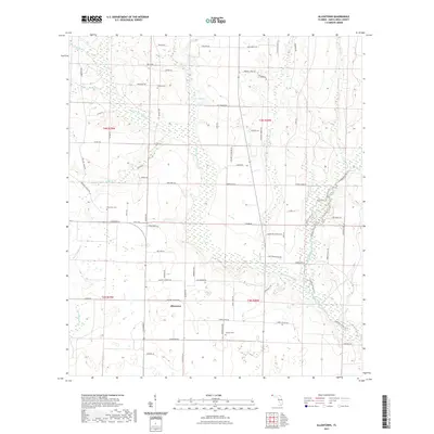
2021 Map of Allentown
USGS Topo · Published 2021About this map
Allentown serves as the central hub for this rural portion of Santa Rosa County, where the landscape is defined by the winding drainages of Big Coldwater Creek and its many tributaries. The area's settlement history is traced through small family and community burial grounds, including Walling Cem, Pine View Cem, and Chavers Cem, which remain as quiet landmarks among the local road network. The terrain is notably dissected by watercourses such as W Fork Big Coldwater Cr, Blackjack Cr, and Juniper Cr, creating a complex pattern of wetlands and wooded stream buffers.
Find a feature on this map
81 named features on this map. Tap any name to fly to it.
Don’t see what you’re looking for? This feature index may not catch every label — zoom into the map to look around manually.
Map Details
Editions of this 2021 Allentown Map
This is the sole edition of this map. No revisions or reprints were ever made.
Other maps of this area

1920 · Milton
USGS Topo · 1:62,500

1934 · Harold
USGS Topo · 1:62,500

1937 · Harold
USGS Topo · 1:62,500

1938 · Harold
USGS Topo · 1:62,500

1941 · Milton
USGS Topo · 1:62,500

1943 · Milton
USGS Topo · 1:62,500

1943 · Jay
USGS Topo · 1:62,500

1948 · Munson
USGS Topo · 1:62,500

1950 · Munson
USGS Topo · 1:62,500

1957 · Pensacola
USGS Topo · 1:250,000