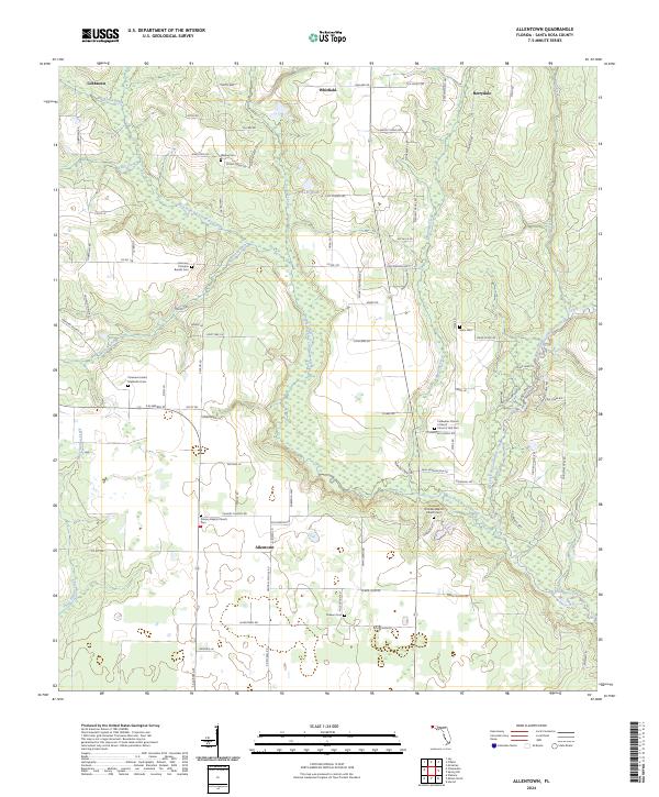
2024 Map of Allentown
USGS Topo · Published 2024About this map
Allentown and the surrounding Santa Rosa County landscape are defined by the intricate drainage of the Coldwater Creek system. The map reveals a rural community where life and memory are anchored by numerous small congregations and family burial grounds, such as Harmony Primitive Baptist Cem and Walling Cem. The hydrological network is particularly dense here, featuring the West Fork Big Coldwater Creek and East Fork Big Coldwater Creek, which carve through the terrain alongside smaller tributaries like Blackjack Creek and Kelly Creek.
Find a feature on this map
100 named features on this map. Tap any name to fly to it.
Don’t see what you’re looking for? This feature index may not catch every label — zoom into the map to look around manually.
Map Details
Editions of this 2024 Allentown Map
This is the sole edition of this map. No revisions or reprints were ever made.
Other maps of this area

1920 · Milton
USGS Topo · 1:62,500

1934 · Harold
USGS Topo · 1:62,500

1937 · Harold
USGS Topo · 1:62,500

1938 · Harold
USGS Topo · 1:62,500

1941 · Milton
USGS Topo · 1:62,500

1943 · Milton
USGS Topo · 1:62,500

1943 · Jay
USGS Topo · 1:62,500

1948 · Munson
USGS Topo · 1:62,500

1950 · Munson
USGS Topo · 1:62,500

1957 · Pensacola
USGS Topo · 1:250,000